Alaska Road Maps
United States Map > Alaska > Interactive Map
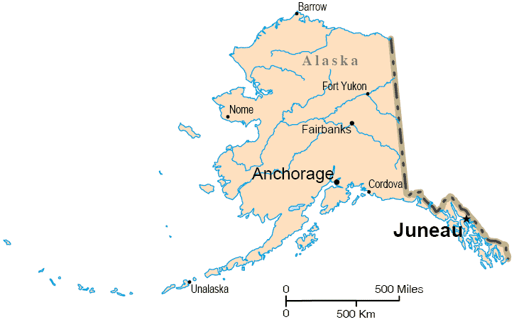
The State of Alaska
The Alaska map includes only the state of Alaska, and the map does not show the road network. Alaska is known as "America's last frontier", and it is the only state in the USA that extends above the Arctic Circle. For Alaska road and highway information, please see this Alaska road map page.
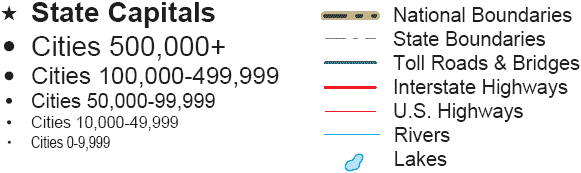
Alaska Road Map Legend
Alaska is not contiguous to the so-called "lower 48" states, but is part of the North American land mass. Alaska also includes a number of coastal islands along its southeastern coast as well as the Aleutian islands to the southwest.
Although Alaska has an adequate transportation network, many areas are not accessible by road. No interstate highways run through the state of Alaska.
Interactive Alaska Map
United States Road Map Menu
| Detailed Road Maps of United States Regions | |||||
|---|---|---|---|---|---|
| Alaska | Northwest | Northern Rockies | Northern Plains | Upper Midwest | Northeast |
| Far West | Central Rockies | Central Plains | Midwest | Middle Atlantic | |
| Hawaii | Southwest | Southern Rockies | South Central | Deep South | Southeast |
Copyright © 2006-2024 United-States-Map.com. All rights reserved.