Central Plains Road Maps
United States Map > Central Plains > Interactive Map
Central Plains States
The Central Plains map includes Nebraska, Kansas, southern South Dakota and Minnesota, western Iowa and Missouri, and northern Oklahoma. This region is well-suited to large-scale agricultural enterprises, and it is sometimes called the "Bread Basket" of America. For detailed maps of these individual states, see Nebraska maps, Kansas maps, South Dakota maps, Minnesota maps, Iowa maps, and Missouri maps, respectively.

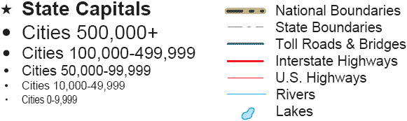
Road Map Legend
A northern cross-country route, Interstate 90, runs from west to east through South Dakota and southern Minnesota. A central cross-country route, Interstate 80, runs from west to east through Nebraska and Iowa. Further south, Interstate 70 runs from west to east through Colorado, Kansas, and Missouri. Still further south, Interstate 40 runs from west to east through New Mexico, Oklahoma, and Arkansas.
Interstate 35 runs from north to south through Minnesota, Iowa, western Missouri, eastern Kansas, and Oklahoma.
Interactive Central Plains States Map
United States Road Map Menu
| Detailed Road Maps of United States Regions | |||||
|---|---|---|---|---|---|
| Alaska | Northwest | Northern Rockies | Northern Plains | Upper Midwest | Northeast |
| Far West | Central Rockies | Central Plains | Midwest | Middle Atlantic | |
| Hawaii | Southwest | Southern Rockies | South Central | Deep South | Southeast |
Copyright © 2006-2024 United-States-Map.com. All rights reserved.