Hawaii Road Maps
United States Map > Hawaii > Interactive Map
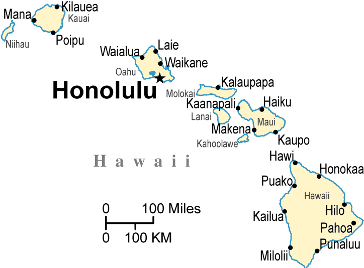
The State of Hawaii
The Hawaii map includes only the state of Hawaii, and the map does not show the road network. Pearl Harbor is located in Hawaii, and the state is known for Kilauea Volcano and its beautiful beaches. For Hawaii road and highway information, please see this Hawaii road map page.
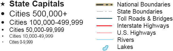
Hawaii Road Map Legend
The major Hawaiian islands include Hawaii (the largest island), Oahu, Molokai, Lanai, Maui, Kahoolawe, Kauai, and Niihau.
Hawaii has an adequate transportation network, but no interstate highways run through Hawaii.
Interactive Hawaii Map
United States Road Map Menu
| Detailed Road Maps of United States Regions | |||||
|---|---|---|---|---|---|
| Alaska | Northwest | Northern Rockies | Northern Plains | Upper Midwest | Northeast |
| Far West | Central Rockies | Central Plains | Midwest | Middle Atlantic | |
| Hawaii | Southwest | Southern Rockies | South Central | Deep South | Southeast |
Copyright © 2006-2024 United-States-Map.com. All rights reserved.