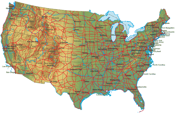
United States Map > USA Terrain Map

Terrain Map of the Lower 48 States
This terrain map of the United States includes the contiguous 48 states, but excludes the states of Alaska and Hawaii. This terrain map will normally fit on letter size paper (8 1/2 inch by 11 inch), in portrait mode, with left and right margins each set to about 0.4 inches.The physical geography of the United States' contiguous 48 states consists of four primary terrain features. The western mountains stretch from Washington, Idaho, and Montana in the northwest down to California, Arizona, and New Mexico in the southwest. To the east of these mountains lie the Great Plains, which cover the central third of the country. The Appalachian Mountains run from northern Maine down to northern Georgia and Alabama. The eastern coastal plain runs along the Atlantic Coast from Maine in the north to Florida in the south, then westward along the Gulf of Mexico coast to Texas.
Copyright © 2006-2026 United-States-Map.com. All rights reserved.