
United States Map
United States Map > •
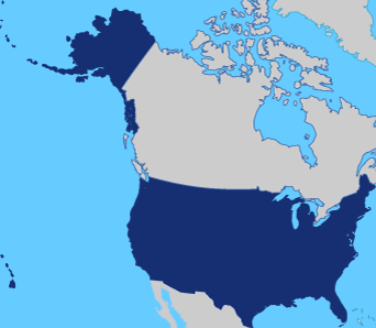 |
There are specific maps created for every purpose. The United States federal government produces hundreds of maps of the United States, ranging from general reference maps to thematic maps which focus on United States history, resources, agriculture, transportation, military installations, recreational areas, and other themes. Commercial map makers also produce many general and thematic US maps, in forms ranging from atlases to classroom wall maps to small, pocket-sized road maps.
A wealth of United States maps is stored in the vaults of map libraries, historic societies, and land offices. In most cases, the original maps may be examined onsite, but some map sources such as the Library of Congress and the National Archives offer reproductions for a fee.
United-States-Map.com features a series of printable road maps, topo maps, and terrain maps of the United States and its regions.
Printable United States Maps
| These USA maps fit on letter-size paper in portrait mode. | |||
|---|---|---|---|
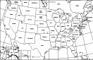
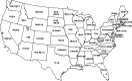 Outline Map
of the Lower 48 States |
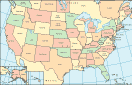
 Color Map
of the Lower 48 States |
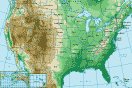
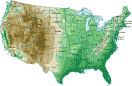 Topo Map
of the Lower 48 States |
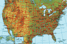
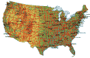 Terrain Map
of the Lower 48 States |
 Outline Map of USA
and Surrounding Areas |
 Color Map of USA
and Surrounding Areas |
 Topo Map of USA
and Surrounding Areas |
 Terrain Map of USA
and Surrounding Areas |
Regional United States Road Map Menu
| Detailed Road Maps of United States Regions | |||||
|---|---|---|---|---|---|
| Alaska | Northwest | Northern Rockies | Northern Plains | Upper Midwest | Northeast |
| Far West | Central Rockies | Central Plains | Midwest | Mid Atlantic | |
| Hawaii | Southwest | Southern Rockies | South Central | Deep South | Southeast |
Regional United States Topo Map Menu
| Detailed Topographical Maps of United States Regions | |||||
|---|---|---|---|---|---|
| Alaska | Northwest | Northern Rockies | Northern Plains | Upper Midwest | Northeast |
| Far West | Central Rockies | Central Plains | Midwest | Mid Atlantic | |
| Hawaii | Southwest | Southern Rockies | South Central | Deep South | Southeast |
Detailed printable maps of the USA, its surroundings, and its capital city:
- 7 1/2 inch wide Political Map of the USA, showing the Lower 48 states.
- 7 1/2 inch wide Terrain Map of the USA, showing the Lower 48 states.
- 10 inch wide map of the United States (excluding Alaska and Hawaii).
- 10 inch wide United States Map with adjacent land and water areas.
- Tabloid size Map of United States, showing natural and political features.
- Washington, DC Map, showing roads and important points of interest.
Visit these companion sites for more United States maps and information:
- Online Atlas for descriptions, maps, and photos of individual USA states.
- Interstate Highway Map for a map of interstate highways and major cities.
- State Maps for online road maps, street maps, and relief maps of each state.
- Maps and Directions for map publishers plus online driving direction services.
- State Abbreviations for postal abbreviations of each USA state and district.
Related sites featuring maps plus cartographic and geographic information:
- The National Map topographic map from the US Geological Survey.
- Traffic and Road Closures from the Federal Highway Administration.
- America's Byways from the National Scenic Byways Online program.
- Reference Maps from the United States Census Bureau.
- Thematic Maps from the United States Census Bureau.
All rights reserved. Terms of Use.
For your convenience, related site links will open in a new window.
Maps copyright © Map Resources.