Northeastern USA Road Maps
United States Map > Northeast > Interactive Map
Northeastern States
The Northeastern map includes the New England states of Maine, New Hampshire, Vermont, Massachusetts, Connecticut, and Rhode Island, as well as New York, northern New Jersey, and northern Pennsylvania. This region features a brisk climate, with cold, snowy winters. Several of America's leading universities are located in New England. For detailed maps of individual New England states, see Maine maps, New Hampshire maps, Vermont maps, Massachusetts maps, Connecticut maps, and Rhode Island maps, respectively.

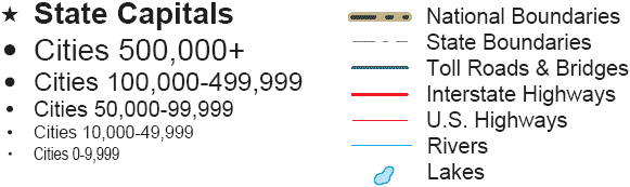
Road Map Legend
The northernmost cross-country thoroughfare, Interstate 90, runs from west to east through Ohio, northwestern Pennsylvania, New York, and Massachusetts. Interstate 80, a major cross-country travel artery, runs from west to east through Ohio, northern Pennsylvania, and New Jersey. Further south, Interstate 70 runs from west to east through Ohio and southern Pennsylvania.
The primary East Coast thoroughfare, Interstate 95, runs from north to south through Maine, southeastern New Hampshire, Massachusetts, Rhode Island, southern Connecticut, southern New York, New Jersey, Delaware, and Maryland. Further west, Interstate 81 runs from north to southwest through New York, Pennsylvania, and Maryland.
Interactive Northeastern States Map
United States Road Map Menu
| Detailed Road Maps of United States Regions | |||||
|---|---|---|---|---|---|
| Alaska | Northwest | Northern Rockies | Northern Plains | Upper Midwest | Northeast |
| Far West | Central Rockies | Central Plains | Midwest | Middle Atlantic | |
| Hawaii | Southwest | Southern Rockies | South Central | Deep South | Southeast |